Category:Grade II listed buildings in Wrexham County Borough
Jump to navigation
Jump to search

Wikimedia category | |||||
| Upload media | |||||
| Instance of | |||||
|---|---|---|---|---|---|
| |||||
Subcategories
This category has the following 17 subcategories, out of 17 total.
5
- 55 Hope Street, Wrexham (3 F)
F
- Froncysyllte War Memorial (7 F)
G
- Gwersyllt War Memorial (7 F)
H
- Holt Market Cross (5 F)
L
N
- Grosvenor Lodge, Wrexham (3 F)
R
- Rossett Hall (3 F)
S
T
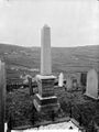
- Trevor Mausoleum, Chirk (6 F)
W
- War memorial at Bangor-on-Dee (12 F)
- Wrexham war memorial (10 F)
- Wynnstay Arms Hotel, Wrexham (6 F)
Media in category "Grade II listed buildings in Wrexham County Borough"
The following 37 files are in this category, out of 37 total.
-
 24, Park Street, Ruabon.jpg 1,350 × 1,800; 449 KB
-
 Allington Farm Gatehouse.jpg 3,000 × 4,000; 1.08 MB
-
 Brick building at Pen-y-bont - geograph.org.uk - 768572.jpg 640 × 579; 96 KB
-
 Broughton Hall Lodge 1.jpg 3,120 × 4,160; 3.71 MB
-
 Butchers' Market, Wrexham.jpg 2,560 × 1,920; 2.8 MB
-
 Central Arcade, Wrexham.jpg 1,918 × 1,919; 810 KB
-
 Converted mill at Llanarmon DC - geograph.org.uk - 269409.jpg 480 × 640; 78 KB
-
 Corner barber shop in Ruabon - geograph.org.uk - 4845556.jpg 800 × 727; 158 KB
-
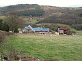 Farm near Bedwlwyn 1 - geograph.org.uk - 325712.jpg 640 × 480; 58 KB
-
 Farm near Bedwlwyn 2 - geograph.org.uk - 325719.jpg 640 × 480; 82 KB
-
-
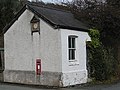 GVT waiting room at Dolywern - geograph.org.uk - 1772733.jpg 640 × 480; 296 KB
-
 GVT waiting room at Pontfadog - geograph.org.uk - 1307484.jpg 640 × 480; 108 KB
-
 Halghton Forge.jpg 4,160 × 3,120; 3.49 MB
-
 Holt Hall.jpg 4,000 × 3,000; 1.34 MB
-
 Johnston's Cottage and Home Farm, Chirk Castle 01.jpg 4,000 × 3,000; 5.11 MB
-
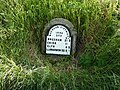 Llanarmon DC milestone - geograph.org.uk - 6236004.jpg 2,448 × 1,836; 2.38 MB
-
 Marchnad Gyffredinol, Wrecsam.jpg 2,560 × 1,920; 2.99 MB
-
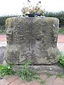 Old cross base, Chester Road, Gresford - geograph.org.uk - 1465043.jpg 480 × 640; 104 KB
-

-
 Old Milestone by the B4500, Llanarmon Dyffryn Ceiriog - geograph.org.uk - 5497635.jpg 1,200 × 1,600; 655 KB
-
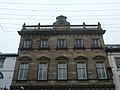 Provincial Welsh Insurance building, 29 High Street, Wrexham.jpg 2,560 × 1,920; 2.58 MB
-
 St Mary's Church, Ruabon, Sundial - geograph.org.uk - 589688.jpg 462 × 618; 199 KB
-
 Ruabon Gates - geograph.org.uk - 567784.jpg 640 × 480; 70 KB
-
 School Room, Wynnstay.jpg 4,000 × 3,000; 5.02 MB
-

-
 St Chad's Church, Holt - geograph.org.uk - 6146748.jpg 800 × 757; 142 KB
-
 St Chad's Church, Holt, Wrexham, Cymru, Wales 05.jpg 4,153 × 2,768; 1.45 MB
-
 The Kennels, Chirk Castle.jpg 4,000 × 3,000; 4.76 MB
-

-
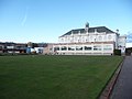
 The Miners Welfare Institute, Llay - geograph.org.uk - 2808204.jpg 640 × 480; 46 KB
-
 The Old Mill Welsh shop - geograph.org.uk - 6236014.jpg 1,958 × 2,611; 1.92 MB
-
-
 Village cross at Holt near Wrexham - geograph.org.uk - 5246235.jpg 5,184 × 2,920; 5.66 MB
-
 Wall near stables at Chirk Castle.jpg 4,000 × 3,000; 4.79 MB
-
 Wrexham Butchers Market 2017.jpg 3,104 × 2,996; 1.66 MB
-
 Llay Miners Welfare Institute - geograph.org.uk - 204700.jpg 640 × 480; 88 KB


,_Llansanffraid_Glyn_Ceiriog_NLW3362495.jpg)


